 MY ACCOUNT
 STORAGE LEVELS
 WATER DATA
 ANNOUNCED ALLOCATIONS

Mega Litres


Structure description
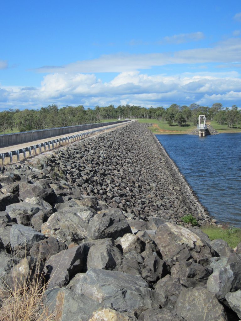
EARTH & ROCKFILL EMBANKMENT
Location
Facilities
-

Boat Ramp
-
Car Parking
-
Road Access
-
Lookout
-
Picnic Areas
-
Toilets
-
Rubbish Bins
-
BBQs
-
Treated Water
-
Camping


Additional information
Management
The north west recreational facilities are owned and managed by Sunwater. The eastern recreational facilities are owned and managed by South Burnett Regional Council.
Boating
Boating activities are permitted, however, operators are reminded to read and obey the signs, look for hazards, boat to conditions and stay away from the dam wall by at least 100 metres, as marked by the buoy line, or as signed. Water activities including swimming, kayaking and sailing are permitted among other activities, however, please note the exclusion zones as signed. The boat ramps are owned by Sunwater and managed by South Burnett Regional Council. One is adjacent to the dam wall and the other is directly below the camping area.
For more boating information, refer to Maritime Safety Queensland.
Fishing
Fishing is permitted at Lake Barambah, Sunwater does not permit onshore fishing on or near the dam wall. Fishers are reminded to read the signs and look for hazards. To learn what fish are stocked at this dam, visit the Department of Agriculture and Fisheries website. A Stocked Impoundment Permit Scheme (SIPS) permit is required to fish in this dam and recreational fishing rules apply.
Call Fisheries Queensland on 13 25 23 to locate your nearest fishing permit outlet or apply online.
Camping
Privately owned and operated camping and accommodation is available at Bjelke-Petersen Dam in the designated camping area.
Pets
For everyone’s enjoyment and safety, please keep your pet on a leash or restrained during your visit.
Rubbish
Help us keep all recreational areas clean and tidy by using the rubbish bins provided. If rubbish bins are full or unavailable, please take your rubbish with you. Please also take any seafood rubbish with you to reduce odour.
BBQs
There are recreational BBQs available for use. Please use common sense when around open flame. Contact 000 to report uncontrolled fire.
Antisocial Behaviour
If you observe vandalism, antisocial behaviour or any illegal activities, please contact the Police immediately on 000 to ensure we keep the dam safe and enjoyable for all.
Commercial or large group activities
Please note that approval is required for the use of Sunwater land for any organised event or function other than normal visitor activities in approved recreational areas. Events or functions include, but are not limited to fishing, swimming, rowing, boating or skiing competitions or displays, community events, weddings or other organised on-land activities. To gain approval, submit a General Application for Access to Sunwater Land or Infrastructure and Events or contact us on 13 15 89.
Motorcycles and other vehicles
The recreational use of motorcycles and four wheelers within the area and the surrounding private property is strictly prohibited. Please practise caution when driving all other vehicles in the area. The speed limit in the camping area is 20km/h unless otherwise signed.
Hazards
There is the potential of submerged trees, weeds and other objects. Floating objects may be present after an inflow or flood event. Fast flowing water may be released suddenly from the spillway.
Read the signs and stay safe
For your own safety, please take note of the signs around the dam including those regarding private property and trespassing.
The signs indicate hazards to watch out for and areas to avoid. Keep an eye on your children and inform them of the hazards and permitted areas.
Emergency Management
View the Bjelke-Petersen Dam Emergency Action Plan, here.
Recreation Facility Upgrade Project
In 2022, the Queensland Government announced Sunwater would receive $24.5 million over five years to upgrade and maintain recreation facilities at Sunwater assets across the state. Find out more about this project here.
All persons entering Sunwater property at their own risk should exercise due care and attention and must comply with all signs, notices, the lawful directions of Sunwater, Sunwater staff, all laws, regulations and applicable standards (e.g. boating, fire, road usage). All liability of Sunwater (or its subsidiaries) to you or any other person for loss or damage of any kind (however caused, including by negligence) arising from or relating in any way to access to, or use of, Sunwater property is excluded.
Playing safe
Stay safe at dams and weirs by looking out for potential hazards and risks.
Underwater hazard information
Bjelke-Petersen Dam has numerous underwater hazards present at various storage levels.
Sunwater conducted an underwater survey in August 2021 which identified the location of various hazards.
Maps showing these hazards are available below. Please note, these maps DO NOT identify every hazard and should be used as a guide only. The location, type and depth of obstructions change over time due to general water movements, flood events and other natural occurrences.
It is the responsibility of recreational users and visitors to be aware of the risks at the weir and when operating a vessel on the lake. Always exercise caution, assess conditions and read the signs.
Submerged hazards maps
The maps in this section provide a visual representation of the location of submerged hazards at various supply levels at Bjelke-Petersen Dam.
- Submerged hazard map 1: 10%
- Submerged hazard map 2: 25%
- Submerged hazard map 3: 50%
- Submerged hazard map 4: 75%
- Submerged hazard map 5: 100%
Dam history
Bjelke-Petersen Dam
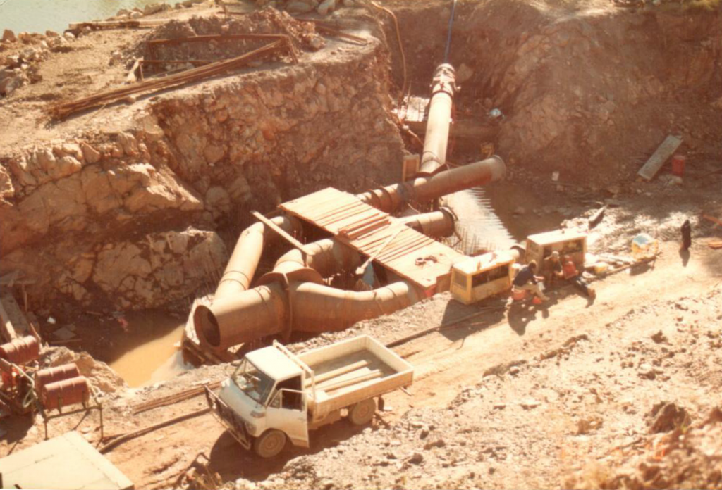
The dam forming Lake Barambah is named after the fiercely pro-development former state premier, Sir Joh Bjelke-Petersen, who gave the green light for the last great dam project in Australia — the Burdekin Falls Dam in North Queensland that was started in 1982. Construction of the dam that bears his name commenced two years later in 1984.
The Bjelke-Petersen Dam, near Moffatdale in the South Burnett, captures the flows of Barker Creek, Four Mile Creek, Six Mile Creek, Frickey Creek and Cattle Creek to create Lake Barambah. It was completed in 1988.
After reviewing rainfall data for the catchment, a decision was made to raise the dam’s spillway, which was finished in 2007.
Lake Barambah, which is named after one of the first cattle stations in the area, covers about 2500 ha and is renowned for its bass fishery.